Quincy Watershed urban design
Urban Studio at Harvard Graduate School of Design
Academic Work, 2016
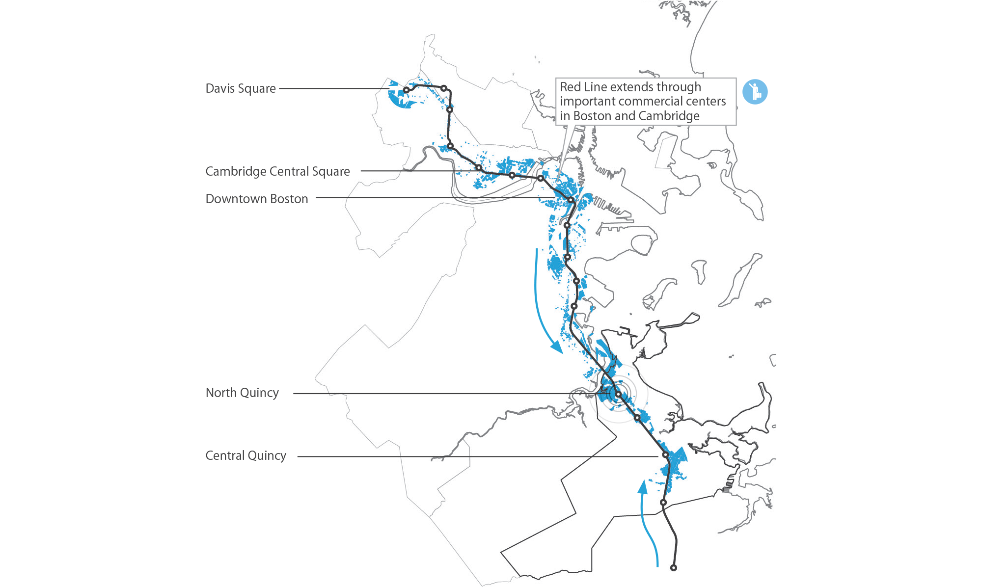
Description: The task of the studio was to analyze various aspects of the urban planning environment in Quincy. Through the analysis, the project focuses on 3 major metro stations that connect Quincy to downtown Boston. Students are to propose an urban design along with an implementation plan in the form of a transportation-oriented-development (TOD).
Proposition: In the late 1960s, the wetlands around North Quincy were paved over, impairing their function to protect the area from flooding and filtering pollution before entry into the Neponset river. This project investigates the idea of a revitalized wetland park as a catalyst for redeveloping there area with a mixture of uses by increasing the real estate value of the land around it. In beautifying the area and providing a crucial infrastructural function, the idea is to project a vision for its potential for transforming the area into an transportation oriented development and urban office campus. The proposal would begin with State Street Corporation, whose property lies between two parts of the Neponset River Estuary Area of Critical Concern. By highlighting State Street’s profile as a community- and ecologically-oriented developer, the opportunity to rebuild the suburban campus as a more-integrated and dynamic urban campus can yield benefits to both the city, the community, and State Street itself.

Project Overview on the Neponset River Estuary and Quincy, MA

Neponset River Watershed Area Mapping
Much of the extents of the historical wetlands have been paved over to accommodate industrial and business land use, resulting in damage to the local ecosystem and important part of storm water infrastructure. Since the 1950s, the Neponset River Estuary has been heavily polluted. Only recently have efforts been made to protect the estuarine land and life. This goal of this project is to highlight the opportunity for revitalization as it relates to a larger ecological strategy for Quincy.
Strengthen Commercial Draw to Quincy
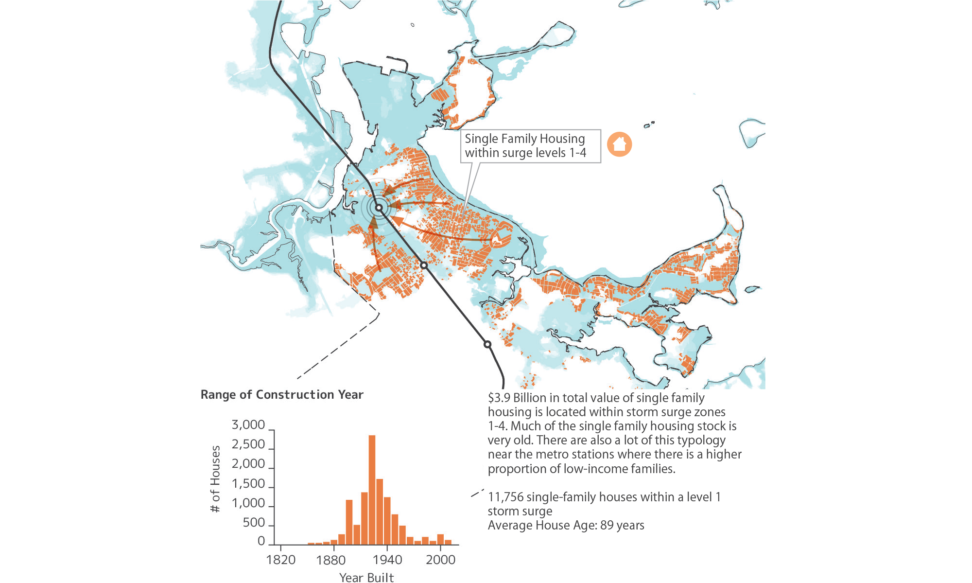
Gradually Shift Residential Out of Vulnerable Areas

Site Context

Phase Diagram
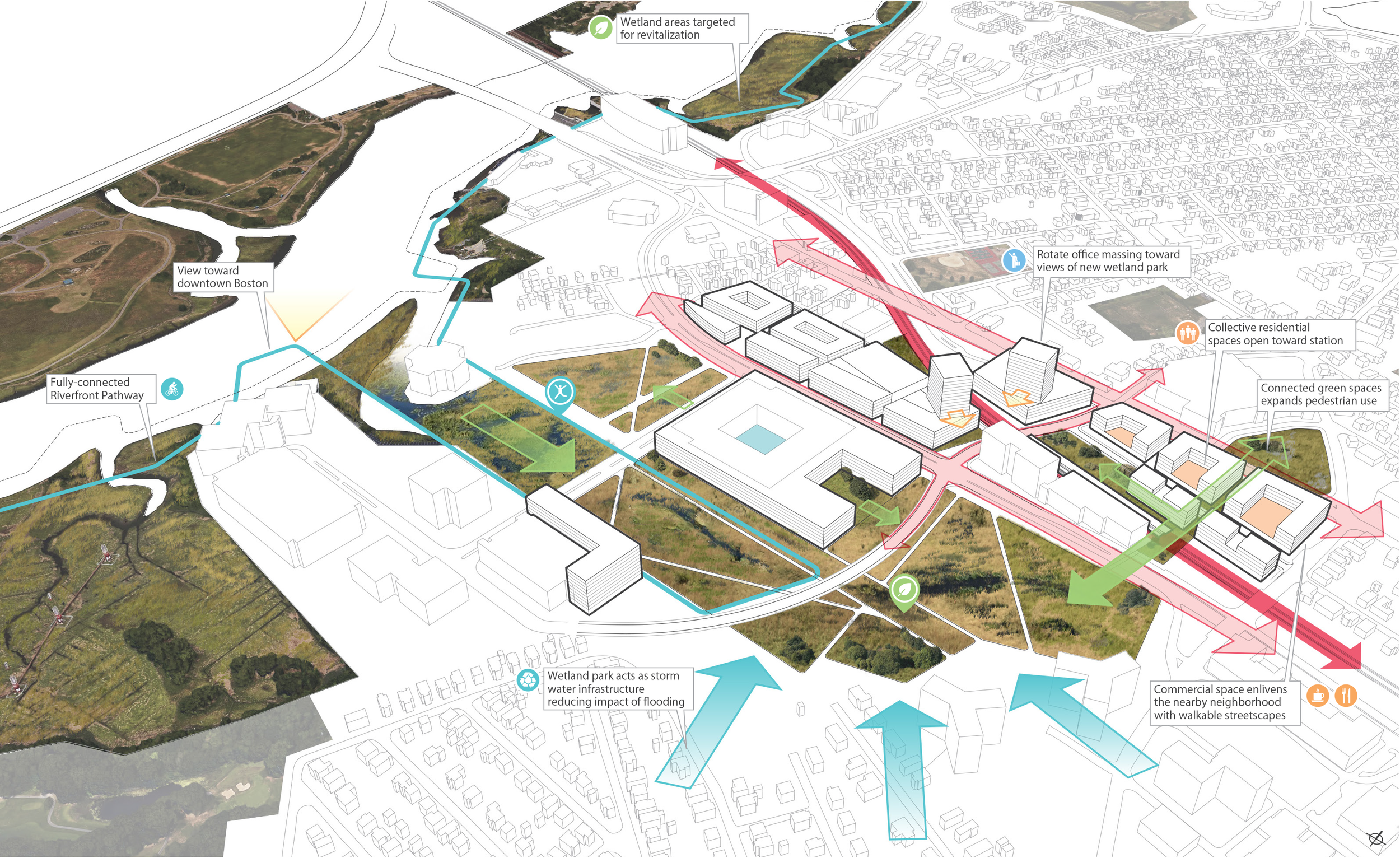
Intervention Overview